• Skip to primary navigation
  • Skip to content
  • Skip to footer
NERC Geophysical Equipment Facility NERC Geophysical Equipment Facility
  • Apply
  • Equipment
  • Schedules
  • Reports
  • Publications
  • Committee
  • Contact

    Scientific Reports - GNSS - Page 5

    Reports from users of our GNSS equipment

    • Scientific Reports
      • Latest
    • By Equipment type
      • EM
      • GNSS
      • GPR
      • Seismic
      • TLS

    Mapping the slip rate and geometry of the Aremogna Fault, central Apennines, Italy

    Report 1034 - Luke N J Wedmore, George Rilley, Victoria Phillips, Peter Sammonds (2016)

    GNSS

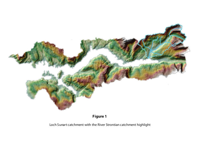
    Terrestrial & Marine Linkages : Mapping the sediment transport network within the River Strontian’s Catchment

    Report 1031 - Craig Smeaton, William E.N Austin, Althea L Davies (2015)

    GNSS

    Measuring post-rifting deformation in Afar, Ethiopia

    Report 1021 - Tim J Wright (2017)

    GNSS

    Insights on the formation of glacial bedforms and ice-bed interaction using fluting field morphometrics, sedimentology and sediment thicknesses

    Report 1008 - Matteo Spagnolo (2015)

    GNSS, GPR

    2015 Quebrada Survey south of Arica, Chile

    Report 1006 - Susan J Conway, Matthew R Balme (2015)

    GNSS

    • «
    • ←
    • 2
    • 3
    • 4
    • 5
    • 6
    • 7
    • 8
    • →
    • »
    • Follow:
    • Twitter (X)
    NERC logoBGS LogoEdinburgh University Logo
    © 2025 NERC Geophysical Equipment Facility. Powered by Jekyll & Minimal Mistakes.