Scientific Report 1135
This is a Reduced Scientific Report resulting from our minor loan scheme.
Summary
This loan supported two components of the NERC Protect NFM (Natural Flood Risk management) project, which assessed the potential for optimisation of peatland restoration for natural flood management benefits.
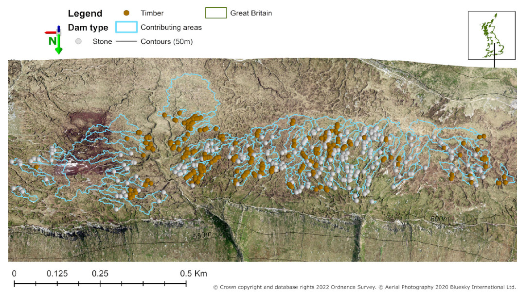
Work package 2 involved an appraisal of peat gully block evolution over 10-years at a restored upland peatland. This involved an assessment of local block conditions using attributes derived from a high resolution digital elevation models (DEMs). Sediment accumulation depth behind blocks was not correlated contributing area, but a significant positive relationship was demonstrated between gully slope/gully height and accumulation depth. Therefore, gully block water storage capacity is compromised faster in deeper, steeper gullies than others.
The loan also enabled part of a PhD research project in collaboration with the Protect NFM. This evaluated a DEM-based volume calculations method for NFM blocks. The 0.25m DEM used for testing was demonstrated to be suitable for dams in large (2-6m width) gullies, with depth-volume functions also derived from the DEM which could be used in hydraulic modeling. 1200m³ of storage was estimated across 200 dams in testing.
The data from the two elements indicate a stabilisation of the system within the 10 year timescale so that around half of the initial NFM capacity (water storage behind gully blocks) can be regarded as permanent additions to catchment storage potential.
The GNSS loan and excellent support provided by NERC GEF team was an incredible help in ensuring these packages of work were carried out to a high standard.
Research facilitated by this loan
The Protect project has collected extensive hydrological data to demonstrate the impact of gully blocking on runoff and on potential NFM benefits. An important part of the analysis was to consider the way in which these benefits would develop over time as the peatland restoration progresses. The survey conducted with the loan instrument was part of an assessment of 10 year old gully blocks on Kinder Scout to understand the early years of this trajectory.
The only GNSS/GPS instruments available to the project at the time of the loan was a handheld Garmin GPS, with accuracy of ~5m. The DEMs used in the analysis were 0.1 - 0.25m resolution, so reliable block locations on the DEM were important for accurate analysis of potential water storage behind the dams. Access to the Leica GNSS enabled higher precision and accurate surveying of block locations, reducing uncertainty of block attributes extracted from the DEM and storage volumes calculated.
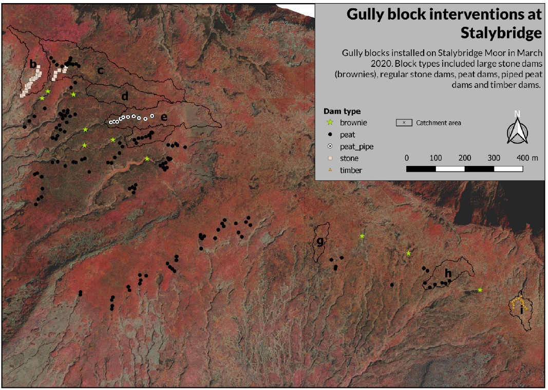
The accurate positioning of the dams has created a significant dataset on the location and condition of 500 peat dams across Kinder Scout which will be an important resource to return to as part of future tracking of the long term peatland restoration and NFM delivery potential of gully blocking.
Survey Methodology and Data Processing
Static survey method, using a base station and rover, were used to collect point locations of blocks/dams. Post-processing was carried out in the Leica Infinity program. The base station was corrected to OS net RINEX data from the nearest station to the study site. The rover points then adjusted to the corrected base.
Subsequent analysis of surveyed blocks was carried out in ArcGIS 10.4 for the block evolution work. Dam points were analysed using Python, handled with the GeoPandas package.
Project Outcomes
Repeated survey points after rover sensor disconnection were carried out, which indicated an 3D accuracy of 0.03m. This is well within the resolution of the DEMs used for analysis, meaning we had higher confidence in the positioning of block points on DEM for analysis. This resulted in lower uncertainty in block attributes derived from the DEM.
Outputs
Howson, T., Evans, M., Allott, T., Shuttleworth, E., Johnston, A., Rees, J., Milledge, D., Edokpa, D., Lockyer, C., Kay, M., Spencer, T., Brown, D., Goudarzi, S., Pilkington, M., 2023. Peatland gully restoration with stone and timber dams (Kinder Plateau, UK). Ecological Engineering 195, 107066. https://doi.org/10.1016/j.ecoleng.2023.107066
Johnston et al. (in prep) A method for high resolution estimates of NFM intervention storage volumes.
Data Archiving
The data will be archived as part of the Protect-NFM submission to the NERC data centre.
Figures and tables


