Scientific Report 1085
This is a Reduced Scientific Report resulting from our minor loan scheme.
Summary
Woodlands in Mediterranean mountains are undergoing succession and densification following the abandonment of traditional forest management. The consequences of these changes on ecosystem functioning remain poorly understood. Our survey of Alto Tajo Natural Park formed part of a wider project to quantify the effects of forest change on the hydrology of Spain. Processing of the data collected in an extensive field campaign accompanying this research is ongoing. The final objectives are to: (1) to map the trajectory of woodland biomass change; (2) to estimate woodland canopy water content, and other vegetation indices, from appropriately filtered and corrected hyperspectral data; (3) to measure woodland canopy transpiration from thermal imagery, and micrometeorological data. Pre-processing of GNSS and remote sensing data was carried out by NERC-ARF-DAN.
Research facilitated by this loan
A NERC Air Research Facility flight was carried out on the behalf of the applicants in June 2017. This flight was used to collect high resolution RGB images of the landscape for structure from motion, in place of the Leica AL S50-II which failed during the campaign, along with hyperspectral data in the visible, near infra-red, short wave infra-red and long wave infra red using the Specim Fenix and Specim Owl. An ADS field spectrometer was also borrowed from the NERC Field Spectroscopy Facility to assist with this project.
Survey Methodology and Data Processing
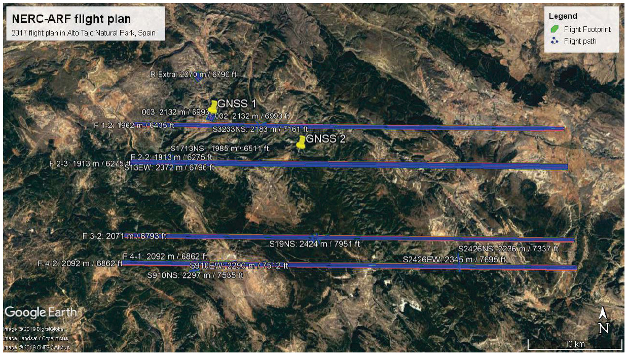
The GNSS was mounted on a tripod as a post-processing base unit at two locations (GNSS1 and GNSS2) within the planned flight path as shown in figure 1. GNSS site 1 was used on the19th June 2017, and GNSS site 2 was used on the 20th and 21st June 2017. The base station was established for between 2 and 1.5 hours prior to the start of the flight, and remained active until and 1 hour after the flight has ended. Coordinates from the base station and associated log sheets were passed to NERC-ARF-DAN to assist in the processing of the on-board navigation data. Data from the base station was used to correct the on-board navigation data from the aircraft by NERC-ARFDAN, and subsequently to accurately geo-reference all data collected during the flights.
Project Outcomes
The facility provided excellent support prior to and during the loan of the GNSS. We greatly appreciate their efforts to accommodate our request given the difficult time frame in which we were working. The GNSS performed well for the duration of the field campaign and enabled high quality correction of the on-board GPS and subsequent geo-referencing of the remote sensing data. This is critical for our project to allow comparison between ground validation data and that collected by NERC ARF.
Outputs
No publications have arisen this loan as of this date.
Data Archiving
Our data is stored by the NERC-ARF Data Analysis Node, Plymouth Marine Laboratory, Prospect Place, Plymouth, PL1 3DH, UK. Data can be accessed by registering a request with nerc-arf-processing@pml.ca.uk or via their FTL server.
Figures and tables

