Scientific Report 1031
This is a Reduced Scientific Report resulting from our minor loan scheme.
Summary
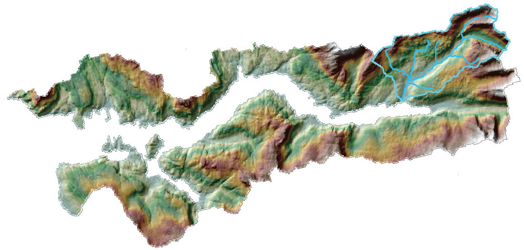
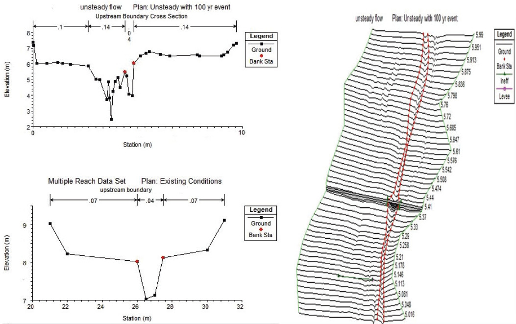
The aim of this project was to build a greater understanding of how “flashy” river networks link the terrestrial and coastal marine (fjordic) environments and facilitate the transfer of sediment and carbon. Through precise mapping of the River Strontian (Fig.1) channel we have created a 1D hydrological model (Fig.2) in HEC-RAS which is capable of modeling basic sediment transport. Through a combination of this model and data collected from the sediment (e.g. % Carbon and Stable Isotope values) we will gain a greater understanding of the mechanisms of sediment and carbon transport in these “flashy” systems.
Research facilitated by this loan
Despite the ecological, biological, and economic importance of coastal oceans, the magnitude and long term stability of coastal carbon stocks are poorly quantified in comparison to many national terrestrial (e.g.Chapman et al.,2009) carbon stocks. A recently commissioned report by Scottish Natural Heritage on ‘blue carbon’ noted that “coastal and offshore sediments are the main repositories for carbon in Scotland’s marine environment” (Burrows et al., 2014). There is still considerable uncertainty over the amount of carbon sequestered in coastal sediments and what drives the transfer of carbon from the terrestrial to the marine environment, both in Scotland and elsewhere in the world.
This project sets out to address some of the main questions that are required to fill gaps in our knowledge and generate a better understanding of carbon in the coastal environment. Using a combination of geophysics and geochemistry we will establish a post-glacial (Holocene) record of carbon content held within Loch Sunart’s sediment (i.e. carbon inventory). This will be the first holistic “Source to Sink” study for a fjordic system.
Project Outcomes
A Real-Time Kinematic (RTK) Survey was carried out of the River Strontian (56.693715, -5.572447) and it tributary’s. The base unit was set up in a secured Scottish Water/SEPA area centrally located in the catchment (56.707391, -5.557274). The river network was surveyed using the cross-section methodology. Points were measured across the river section at 0.25m intervals detailing features and changes in level. Cross-sections were taken at high resolution (100m intervals) in addition to these an ad-hoc approach was taken when river features or points of interest fell between cross sections. An accuracy of around 5-10cm was achieved.
The equipment (Leica VIVA GS10) performed well in challenging conditions within the River Strontain catchment. The catchment has several heavily forested areas where the equipment was expected to struggle yet a connection was established and the survey was completed in these sections with a suitable accuracy. Sections in the lower stretch of the River Stortian could not be surveyed due to adverse weather conditions which resulted in a unusual high flow within the river.
Outputs
Currently no publications have been produced from the data. Ongoing geochemical analysis will be combined with the data collected with the aim of integrating it with a future paper focusing on the transfer of terrestrial carbon to the marine environment (Source to Sink). Additionally the data will feed into Craig Smeaton’s thesis and future publications.
Data Archiving
Once the data has been been fully processed and published it will be uploaded to both St-Andrews University Data Archive Center and the NERC Environmental Information Data Centre operated by Center of Ecology and Hydrology (CEH). All publications produced from this data will be open access.
References
Burrows M.T., Kamenos N.A., Hughes D.J., Stahl H., Howe J.A. and Tett P. 2014. Assessment of carbon budgets and potential blue carbon stores in Scotland’s coastal and marine environment. Scottish Natural Heritage Commissioned Report No. 761.
Chapman, S. J., Bell, J., Donnelly, D. and Lilly, a.: Carbon stocks in Scottish peatlands, Soil Use Manag., 25(2).
Figures and tables


