Overview
The Leica GS10 GNSS is a state-of-the-art GNSS receiver capable of receiving all current GPS and GLONASS signals. A number of our units can also receive signals from the Galileo and Beidou constellations.
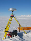
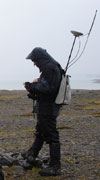
The GS10 can be used as a reference or rover in static, post-processed kinematic (PPK) or real-time kinematic (RTK) mode. Accessories such as backpacks and lightweight adjustable carbon fibre poles can be supplied when required for real-time surveys.
Specifications
Receiver
| Model | GS10 |
|---|---|
| Channels | 120, L1, L2, L2C, L5, GLONASS, Galileo, BeiDou, SBAS |
| RTK enabled? | Yes |
| Power consumption | Typically 3.2W, 270mA |
| Batteries |
|
| External supply | Nominal 12V DC (10.5 to 28V allowed) |
| Weight | 1.20kg |
| Temperature | Operation: -40 to +65 C, Storage: -40 to +80 C |
| Accuracy |
|
| Data logging | SD cards: 1Gb, typically around 280 days raw data at 15 sec rate (GPS+GLONASS) |
| Data Format | Leica RAW data or RINEX |
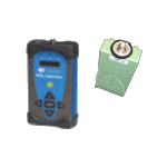
Controller
| Model | CS15 |
|---|---|
| Operating System | Microsoft Windows CE 6.0 |
| Camera | Integrated 2MP fixed focus camera |
| Display | Colour VGA touch screen (sunlight readable) |
| Keypad | Full QWERTY keypad with user definable keys |
| Weight | 0.71kg |
| Temperature | Operation: -30 to +60 C, Storage: -40 to +80 C |
| Battery | Single 2.6Ah/7.4V Li-Ion battery (powers controller for approx. 10 hours) |
| Connectivity | Bluetooth or USB connection to receiver |
Antenna
| Model | AS10 |
|---|---|
| Dimensions | 170 x 62 mm |
| Protection | IP68 |
| Weight | 0.44kg |
| Temperature | Operation: -40 to +70 C, Storage: -55 to +85 C |
Accessories
Choke Ring Antenna
A high quality antenna for blocking multipath reflections (please note that this antenna can receive GPS only, NOT GLONASS).
VHF Radio Modems
Low power (0.5W) radio modems enabling Real-Time Kinematic (RTK) corrections to be sent from the reference station to the rover over a range of up to 10km (line of sight only).
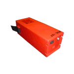
External Battery
A NiMH 12V battery able to supply the Leica receiver. The capacity of this battery is 8Ah.
Battery Charger
An intelligent charger able to charge Li-Ion, Nicad and NiMH Leica batteries.
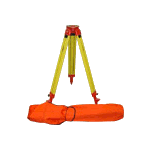
Tripod (Wooden)
A standard wooden tripod supplied in a canvas bag, total weight 6kg.
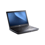
Laptop
A laptop for field processing and viewing of GNSS, GPR and TLS data
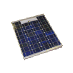
Solar panel
24 and 40W solar panels and regulators are available for long term deployment of the Leica receivers.
Packaging and shipping
Flight cases
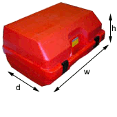 Each GS10 receiver is packaged into a tough red flight case.
| Width | 48 cm |
| Depth | 37 cm |
| Height | 26 cm |
| Weight | typically 8.5kg with standard accessories |
Alloy shipping container
 For shipping purposes, we normally fit two flight cases plus accessories into an alloy container. Depending on accessories requested and number of receivers, other sizes of alloy container may be used. Please ask for further details.
| Width | 80 cm |
| Depth | 60 cm |
| Height | 41 cm |
| Weight | typically 40kg with 2 receivers and accessories |
Courier to a UK destination
The GEF(Edinburgh) will ship loan items to the borrower by courier to UK addresses on a next day basis free of charge. It is the borrowers responsiblity to return the equipment to the GEF, on time and at their own expense via any suitable means.
Please note some GEF equipment uses Lithium Ion batteries. You may need to use a road based courier to return equipment to us, please contact us or see our guide to shipping lithium batteries for further information.
Collection from the GEF
Borrowers may collect and return equipment in person from the GEF offices (in Edinburgh and Leicester).
Shipping outside the UK
The GEF(Edinburgh) only ships to destinations within the UK. It is the borrowers responsibility to arrange transportation and all necessary customs paperwork for any temporary export and re-importation to the UK. You may arrange your own courier to collect equipment from our offices.
User training
New users of our GNSS equipment are required to be trained by Facility staff. Training usually takes place during a one day visit to the GEF offices. Previous users are encouraged to attend for refresher training.
Successful applicants will be invited to contact the Facility to arrange a suitable training date, usually close to the start of the project.
Training is free of charge, however applicants will be responsible for making their own way to the Facility.
Usage guide
Static surveying
Static applications can include
- monitoring the movement of glaciers/ice flows
- deformation networks including volcano monitoring
- precision location during gravity surveys etc.
During static surveys, raw carrier phase data is logged simultaneously to reference and roving receivers and stored on memory cards for later download and post-processing using Leica Infinity software (provided by the GEF). Recording times are generally from tens of minutes to hours at each location.
During longer term deployments it may be possible to power the units via solar panels. The GEF has a number of panels and regulators available, please see the Accessories and FAQ sections for more details.
Post-processed Kinematic (PPK) Surveying
In this mode, carrier phase data is again recorded simultaneously on reference and roving receivers, however the roving receiver is free to move whilst recording. Often, the rover is held stationary for short periods during the survey to accurately record survey points.
PPK (unlike RTK) requires no radio link between the two receivers in the field which results in a simpler setup. A disadvantage is the lack of feedback in the field as to the success of the survey, results only being obtained at a later stage at which point it may be discovered that insufficient data was collected.
Real-time Kinematic (RTK) Surveying
During an RTK survey, data collection is similar to PPK but the rover unit is receiving corrections from the reference receiver via a radio link. Accurate centimetre level positions relative to the reference receiver are then calculated in real-time in the field with no post-processing required.
A higher accuracy can usually be obtained from a PPK survey rather than RTK and we would generally recommend PPK to our users. In certain situations, RTK may be required, for instance when feeding final location data into other instruments during the survey.
With both PPK and RTK surveys, the GNSS antenna can be fitted to a carbon-fibre survey pole for very high accuracy work, or mounted onto the backpack for quicker, lower resolution surveying of large areas.
There are a vast number of applications for carrier phase kinematic surveying (RTK or PPK), from location of ground control points (GCPs) for airborne data calibration, measurement of control targets for our TLS systems to full scale mapping of landscape features for entry into GIS systems.
Frequently asked questions
I need to leave a GS10 receiver out on a long deployment, can I use solar power?
Yes, the GEF have a number of solar panels and regulators suitable for powering the GS10 receiver. You will need to provide a suitable 12V lead-acid battery for the panels to charge. The GEF panels are 24 or 40W nominal output and up to three of them may be connected to our solar regulators.
Is the GS10 waterproof?
Yes, it is waterproof to IP68 standards and can withstand temporary immersion to 1.5m. It is also sand and dustproof.
How long do the batteries last and how much data fits on the card?
Please see the specifications section.
What is the range of the radios for RTK?
Line of sight is essential to get the maximum range from the radios. It is possible to get up to approximately 10km range under ideal conditions, but this is heavily influenced by any obstructions (trees, hills, buildings etc.) and may drop to only 1 or 2km in urban environments.
Should I refer to these systems as “dGPS” in my scientific report?
No, the term “dGPS” has a specific meaning when it comes to the processing of the raw data. “dGPS” uses only the code data from the GPS signal (for further information see this tutorial from Trimble), allowing sub-meter measurement accuracy. The instruments supplied by the GEF make use of carrier phase data from the GPS signal which allows measurement to centimetre level and is known as “relative” positioning.
The correct way to refer to the use of these instruments in your report would be “relative carrier phase positioning”.