Accurate GPS support for an airborne remote sensing study of complex landslide terrains associated with Quaternary glacio-lacustrine deposits of southeast France
2009
This is a Full Scientific Report resulting from NERC Geophysical Equipment Facility Loan 823, principal investigator Dr Malcolm Whitworth.
Abstract
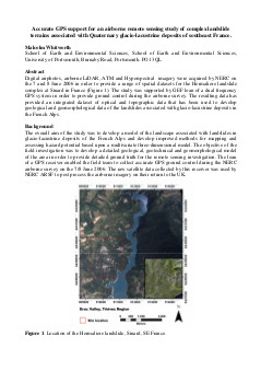
Digital airphotos, airborne LiDAR, ATM and Hyperspectral imagery were acquired by NERC on the 7 and 8 June 2006 in order to provide a range of spatial datasets for the Hermaliere landslide complex at Sinard in France (Figure 1). The study was supported by GEF loan of a dual frequency GPS system in order to provide ground control during the airborne survey. The resulting data has provided an integrated dataset of optical and topographic data that has been used to develop geological and geomorphological data of the landslides associated with glacio-lacustrine deposits in the French Alps.
Full Report
 Accurate GPS support for an airborne remote sensing study of complex landslide terrains associated with Quaternary glacio-lacustrine deposits of southeast France
Cite as:
Whitworth, M., "Accurate GPS support for an airborne remote sensing study of complex landslide terrains associated with Quaternary glacio-lacustrine deposits of southeast France", NERC Geophysical Equipment Facility, Scientific Report 823, 2009